Land transport – from Drivvejen to highway 11
The West Jutland trade
Since ancient times, Gredstedbro by the river Kongeå has been a central hub for the trade route Drivvejen that went from Oddesund and Holstebro to Ribe and further on to the markets in Germany. Over the centuries, the merchandise was shipped - or driven if it was animals - down Drivvejen and sold in the markets in the south.
Drivvejen became a highway that was built in the 1840s and 1850s. West Jutland had close trade links with the Netherlands, England and Germany, but when steam shipping and railway operations took off in the 1870s, the small trade loads gradually disappeared.
Now highway 11 has been straightened out, has been given bypasses and roundabouts. Before then, you have to imagine merchants walking, riding and driving on a wide wheel-rutted track as they made their way through the Jutland heaths and bogs.

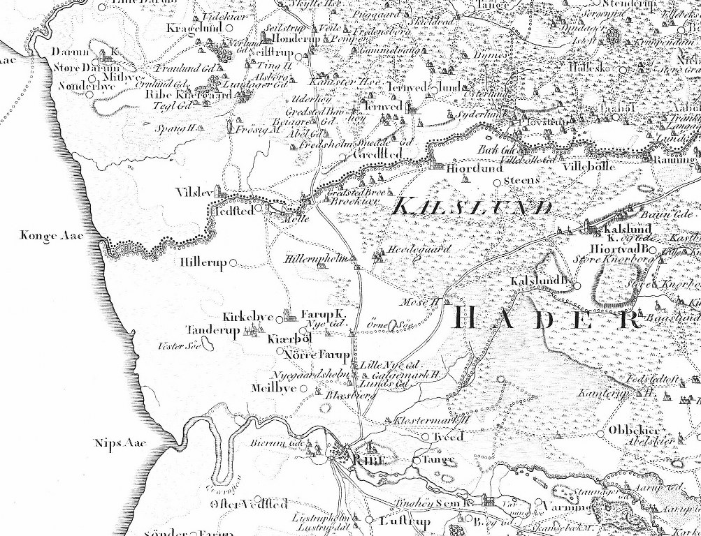
On the Academy of Sciences Map from 1804 you can see Drivvejen’s route and where it crosses the river Kongeå.
The trade goods
In the 1200s, horses were one of the biggest exports from Jutland. It was not working horses, but show horses that were sold to the princes and nobility in Europe. From Ribe’s customs accounts, we know that horse duties in Ribe in the year 1231 collected 350 mark, which corresponds to approximately 8,400 horses.
In the 1400s, bullock trading took off and until the late 1800s, several thousand bullocks walked down Drivvejen every year. The bullocks were led by strong boys and men who walked beside the animals. When the bullock trade was at its height, 50-60,000 bullocks passed through Ribe each year.
Geese and pigs were other live merchandise that could walk independently. Geese had tar smeared under their feet to withstand the long trip. Other items were carried or transported on carts. They included black pots from the area around Varde, Ølgod and Grindsted and lace from Tønder.
Other imported goods over the years have included tufa for church buildings, clothing, silver and Dutch wall tiles.
Traces of Drivvejen
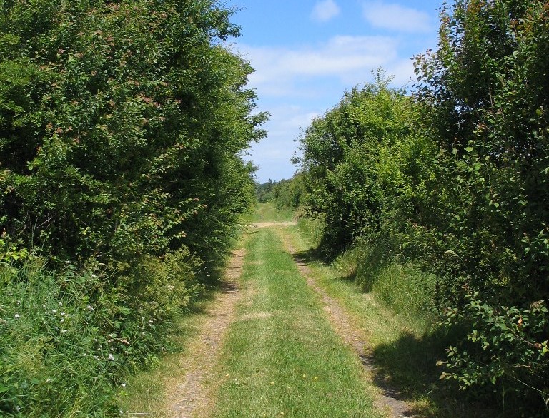
Traces of the ancient trail can still be found along many major roads. In some places, archaeologists have found the remains of ruts and roads, but the clearest indication are the burial mounds, which in some places almost follow the direction of the main road, for example, north of Skjern.
In other places, the wide hedgerows and old field roads show markings of the past trail. Between Rejsby and Gredstedbro, there are still remnants of Drivvejen criss-crossing the main road, including the dirt road called Drivervej north of Ribe.
The landscape also features traces of bullock pens, which are small areas surrounded by earth banks. The animals were gathered here for the night when the men needed a rest.
The ancient roads can also be followed on older maps, where the Academy of Sciences Map from 1804, High topographical maps from 1842-1899 and Low topographical maps from 1901 to 1971 are the best sources to show the old trade route.
You can also look for the old country inns, both the royal privileged inns and illicit drink shops with names like Bi-Lidt (Stay a while), Kom-Igen (Come again) and Kig-Ind (Look in). The inns were close to major thoroughfares, so tired travellers could get some nourishment and a place to rest their weary feet.
Today Drivvejen has been transformed into a walking trail that goes from the border to Oddesund. The path is linked to other walking trails, biking and riding trails around the North Sea, where you can experience the coastal areas and the trade routes of old.
Author: Charlotte Lindhardt

The remains of Drivvejen, the old bullock route. Photo: Charlotte Lindhardt

